NPSO 2022 Annual Meeting
May 20 - 22 Spirit Mountain Lodge, Grand Ronde, Oregon
Field Trips
Saturday May 21, 2022 9 a.m. - 4 p.m. Field Trip # 32
High Peak/Moon Creek Research Natural Area
 Photo: Bureau of Land Management
Artist's conk (Ganaderma applanatum)
Difficulty: Strenuous (3-4 miles) - Steep slopes, off trail
Elevation: 200 feet elevation gain
Group Size Limit: 12
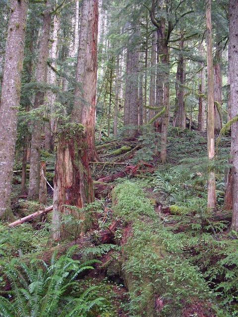
 Photo: Bureau of Land Management
Old growth in High Peak/Moon Creek area
Trip Description: The High Peak/Moon Creek Research Natural Area (RNA) is within the northern portion of the Nestucca River Watershed and is characterized by mature coniferous forest stands. A representative selection of low- to mid-elevation forest associations typical of the northern Oregon Coast Range are found here. Stands in the 80- to 160-year-old age class predominate.
The geologic setting of the RNA owes its origin to the Tillamook Volcanics of the upper middle Eocene. The terrain is rugged with deeply incised drainages.
We will visit the upper sections of the RNA, including an old-growth Douglas fir stand that contains 500-year-old Pseudotsuga menziesii with a western hemlock (Tsuga heterophylla) sub-canopy. Old-growth stands are increasingly uncommon in the northern Oregon Coast Range, and the Moon Creek old-growth stand is the last remaining stand in the area. The few remaining stands of old growth and contiguous late-seral-stage habitat are important for habitat-dependent species with low mobility or small home ranges.
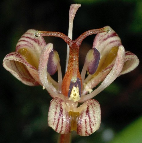
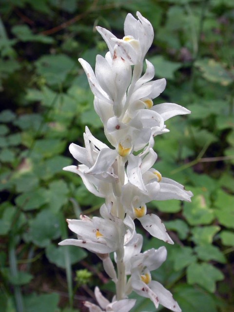
A lovely stand of noble fir (Abies procera) crowns the 2980-foot summit of High Peak. The riparian areas offer a wide variety of trees; tall, medium, and low shrub layers; and delicate understory herbaceous and fern species. Less common plant species include: single-flowered wintergreen (Moneses uniflora), claspleaf twistedstalk (Streptopus amplexifolius), Oregon fetid adder's-tongue (Scoliopus hallii), withered bluegrass (Poa marcida), Phantom orchid (Cephalanthera austiniae), and Fendler's waterleaf (Hydrophyllum fendleri).
Appropriate Clothing and Footwear: Warm clothing, sturdy boots, hiking poles recommended
Special Considerations: Bushwhacking on steep slopes with rocks, exposed tree roots, and uneven terrain
Meeting Place and Time: Trip # 32 leaves at 9 a.m. from Spirit Mountain Lodge entrance. Plan to arrive 30 minutes before departure time to meet your group and arrange carpools.
Driving Miles and Time from Spirit Mountain Lodge: 50 miles, 1.5 hours, 5-8 miles unpaved. Due to some rough roads, high-clearance vehicles are recommended.
Driving Directions: Trip leaders will provide detailed driving instructions.
Leaders: Dan Luoma, Joyce Eberhart
Dan Luoma and Joyce Eberhart, plant science researchers with Oregon State University, Corvallis Chapter
Plant Lists and Other Information: Clink on the links below for more information about this trip.
 Photo: Gerald D. Carr courtesy of Oregon Flora Project
Oregon fetid adder's tongue (Scoliopus hallii) may be found in the area.
 Photo: Aaron I. Liston courtesy of Oregon Flora Project
Phantom orchid (Cephalanthera austiniae)


